The market for Bluetooth location services has significantly grown over the last few years. According to ABI Research, nearly 400 million Bluetooth Location Services devices are forecasted to ship per year by 2022. Bluetooth location services have been developed using the same concept: they leverage Bluetooth Low Energy (BLE) radio to determine if two Bluetooth devices are within range of each other and use received signal strength (RSSI) values to estimate the distance between these two devices. This concept has led to the creation of new and exciting Bluetooth location services solutions. These solutions typically fall into two different categories: positioning systems and proximity solutions. This blog will briefly describe both categories and the use cases for each. Let’s dive in!
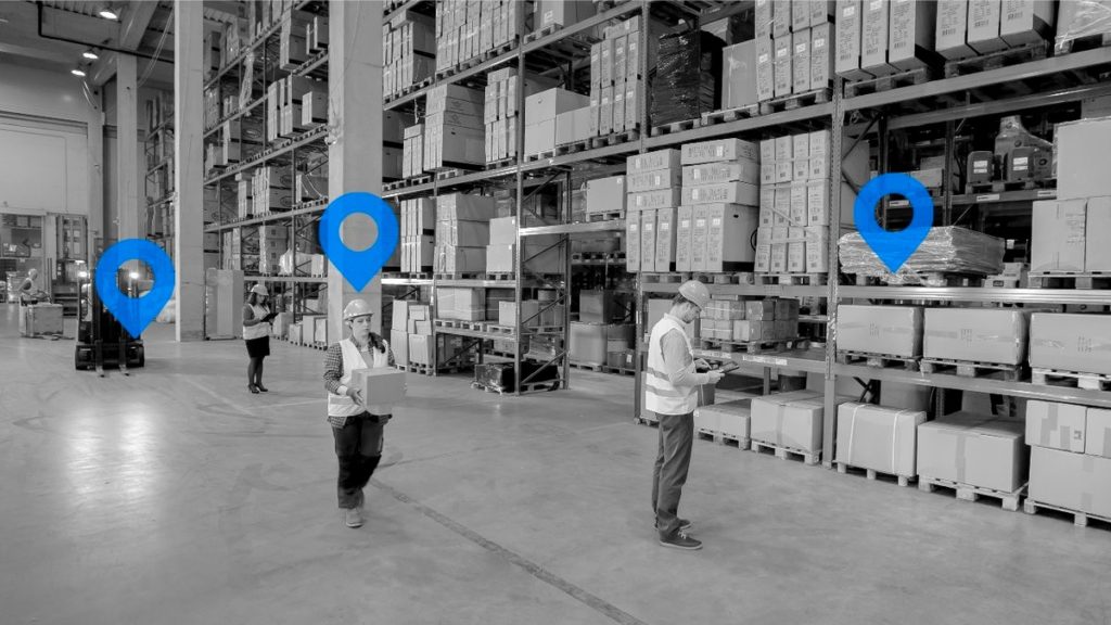
Positioning systems involve two very popular types of Bluetooth solutions: Real-Time Location Systems (RTLS) (i.e., asset tracking) and indoor positioning systems (IPS) for wayfinding. RTLS solutions can be used for tracking both assets and people. For example, these solutions can locate and track the position of equipment, assets, and workers in a construction site and even patients in a hospital environment. Bluetooth receivers or locators as they’re often called, are deployed throughout fixed locations in the environment and will connect back to a centralized server also known as a location engine.
Bluetooth tags are attached to people and/or assets for locationing and tracking purposes. These tags are programmed to frequently transmit signals to estimate the location. Each receiver/locator continuously reports back to the location engine from all the tags it listens to as well as the RSSI from each. This information, as well as the known position of each locator, is used to estimate the position of tags based on a process called trilateration (we’ll cover this topic in our next blog post). Depending on the environment (i.e. floor plan and layout and number of tags deployed), standard Bluetooth RTLS solutions can provide an accuracy of approximately ~1 to 10 meters.
IPS works a little differently than RTLS. Instead of Bluetooth receivers, locator beacons are deployed in fixed locations throughout an area. Take for example a shopping mall or airport. Visitors can use an app on their smartphones to listen for these beacons. Based on which beacons the app can hear, along with the RSSI from each and their known locations, the app can use trilateration, the same process as RTLS, to calculate its current position.
Like RTLS solutions, the location accuracy of Bluetooth IPS solutions depends on the environment (i.e., the floor plan, number of fixed beacons deployed) but the accuracy is ~1 to 10 meters.

Proximity Solutions
Proximity solutions use Bluetooth technology to determine the location of two devices relative to each other. These solutions are usually simpler than positioning systems. A device such as a smartphone is used to determine if another Bluetooth device is within range and how far it is. Item finding and point of interest solutions are the two most common Bluetooth proximity solutions.
Item finding solutions, usually consist of small battery-powered Bluetooth devices (most popular being tags) that are attached to everyday objects like a wallet, keys, medical devices and even tools. Users can install a location services application on their smartphone which can listen to the tags and then determine the nearest location based on the estimated distance of the specific tag. In a typical deployment, the personal property tags will broadcast their location at regular intervals. These solutions have seen significant growth over the last few years because of their compatibility, low cost and ease of use.
Point of Interest solutions, on the other hand, consist of small battery-powered Bluetooth devices (most common are beacons) that are distributed throughout a facility at strategic points to ensure that all spaces are covered. For example, a shopping mall that has beacons deployed throughout the area will send relevant product information to shoppers who install an application on their phones. The Bluetooth radio in the phone will listen for nearby beacons and will receive more information to the shopper based on the location of the beacon(s) it hears.
Recent advancements in Bluetooth technology are enabling more effective and accurate low-cost indoor positioning and location services and have allowed for the expansion into many verticals as well as consumer use. Stay tuned for our next blog post where we will discuss direction-finding using angle of arrival and angle of departure methods as well as trilateration.


